

Now out of Beta! The full version of Inspector 3.0 is now available to all Flyability customers!
Try to for free here.
Flyability have released the first full version of their desktop data processing software for the Elios 2 confined space inspection system. Inspector 3.0 brings powerful new features to confined space inspection analysis — including for the first time, data localisation. This means it is now possible to know the location of issues, problems or defects detected by Elios 2 inside an asset. This further cements Elios 2 as the go-to system for mission-critical inspections within vital and important industrial / infrastructure assets.
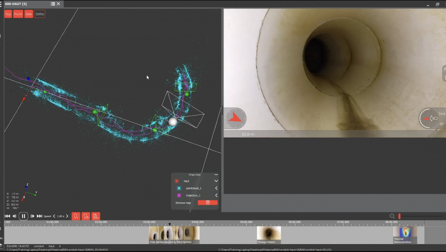
What if you could make a 3D map showing exactly where a defect is located within an asset after an indoor drone inspection — and with almost no processing time required? Now you can with Inspector 3.0.
Inspector 3.0 allows you to visualise, localise and document inspection data so your team (and clients) can use it to make critical decisions. The program generates a sparse-3D model of the Elios’ flight path by combining video data with IMU data.
This is totally unique in the industry: no other confined space or indoor drone system can deliver this kind of accurate location data without the aid of GPS. Of course, in nearly all confined space inspection situations, there is no GPS.

Data Localisation = Big Savings
Figuring out exactly where a defect is located can mean the difference between days or weeks in terms of repair and downtime.
If you have to enter an asset by cutting a hole into it, digging through dirt, or undertaking some other significant effort, the last thing you want is to get inside only to find out that where you entered wasn’t the right place for performing the work that needs to be done.
Not only can incorrect localisation lead to wasted effort, it can also prolong downtimes, leading to potentially huge losses in revenue.
Knowing precisely where a defect is located within an asset can also help companies save money on scaffolding costs, since they can place scaffolding right where it needs to go — and not waste time and money erecting scaffolding everywhere.
How it Works
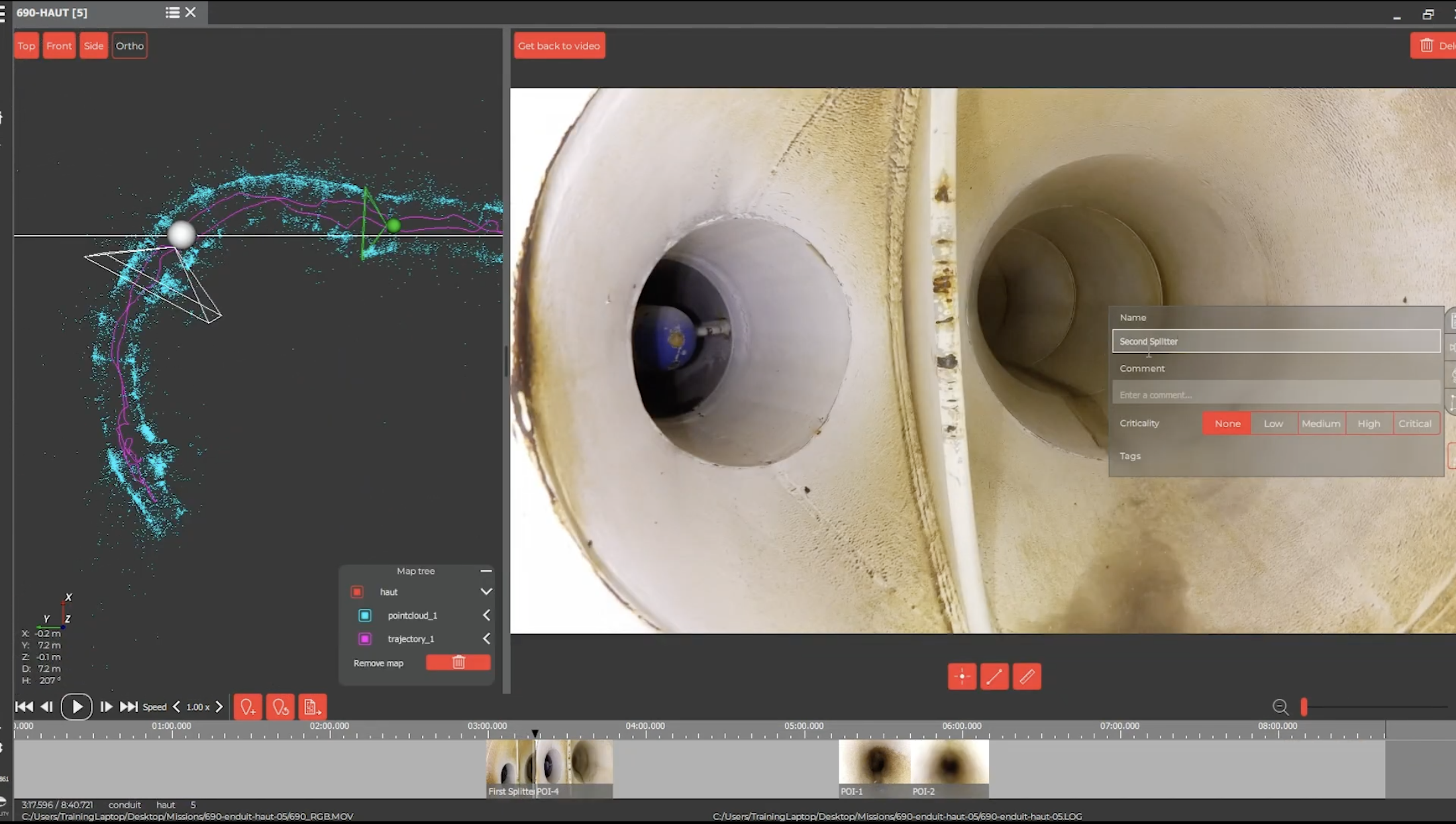
- You fly an indoor inspection mission with the Elios 2 as normal, collecting visual data within the asset.
- As you fly, you identify specific Points of Interest where defects are located, and you mark them using the POI button on the remote controller.
- After the mission, you use Inspector 3.0’s mapping feature to create a sparse 3D map of the asset, showing you the location of your Points of Interest (i.e., your defects and problem areas) inside the asset.
- Inspector 3.0 can generate the indoor 3D map within about 20 to 50 minutes, so it can be available to show clients or senior management on the same day.
1 Comment
Michael Wong May 20, 2022
Hi,
I joined yesterday broadcast and interesting for Elios 3, we would like to invest for our surveying and spatial data acquisition, please send us the quotation and the expecting delivery period.
Leave a comment