

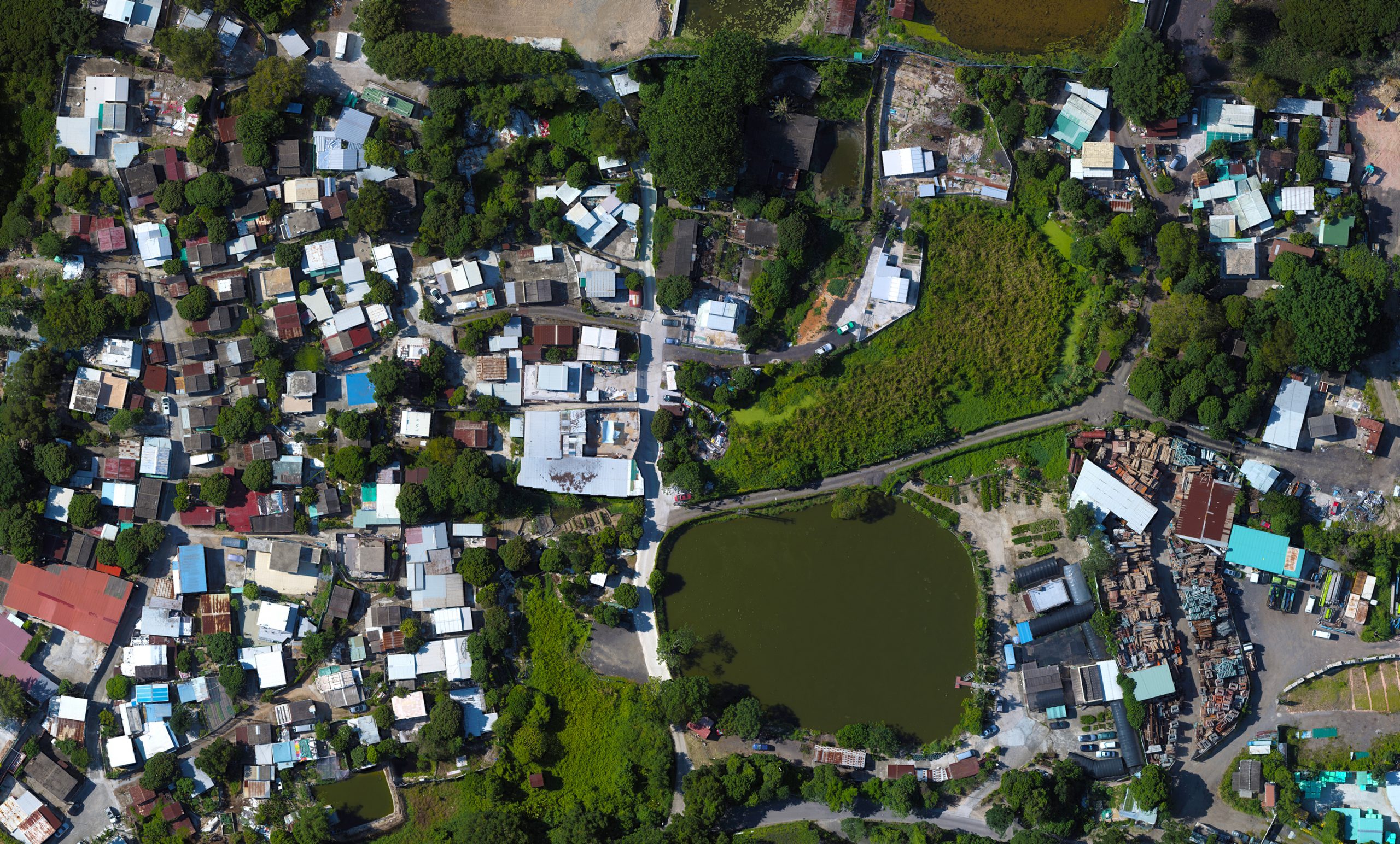
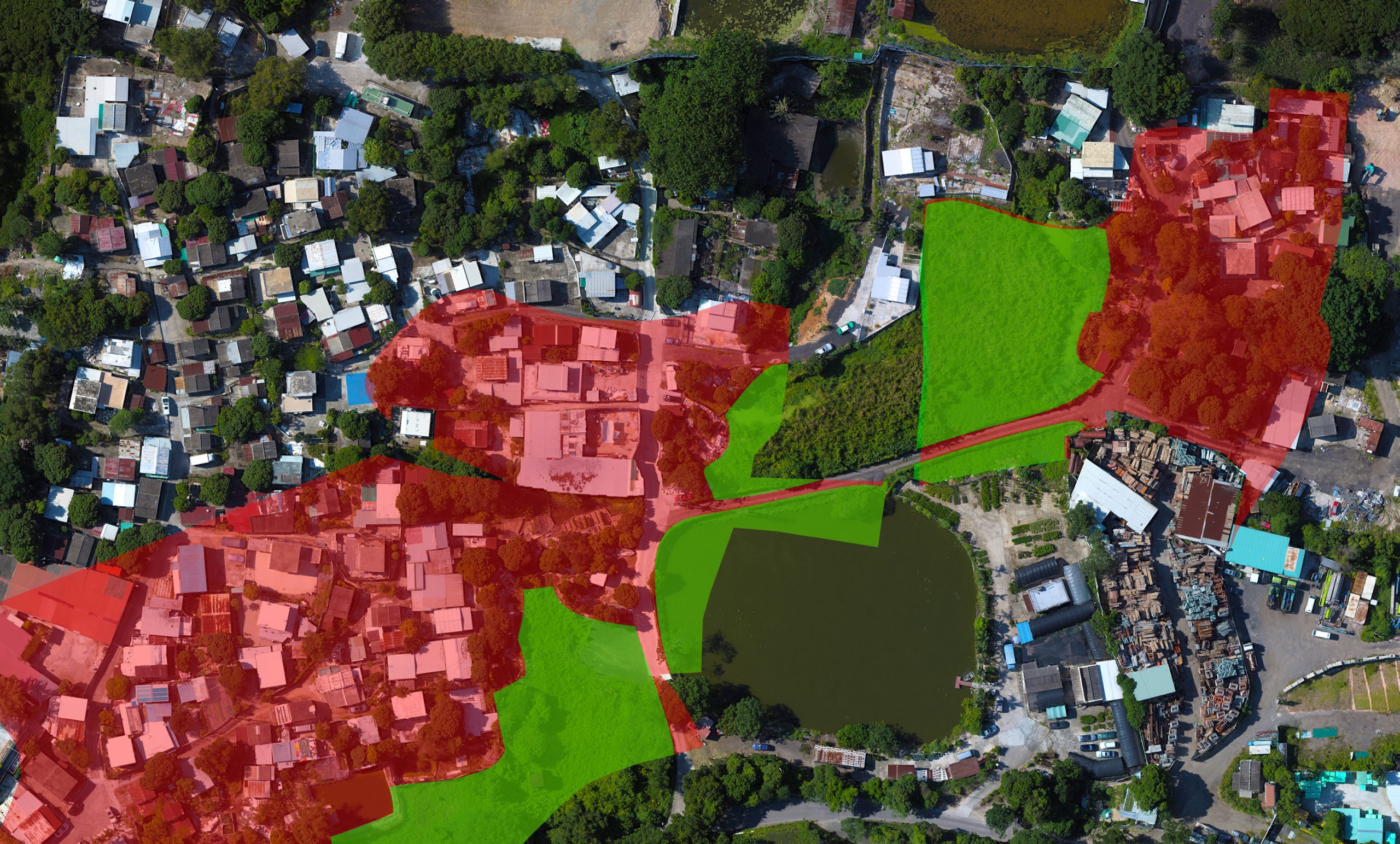
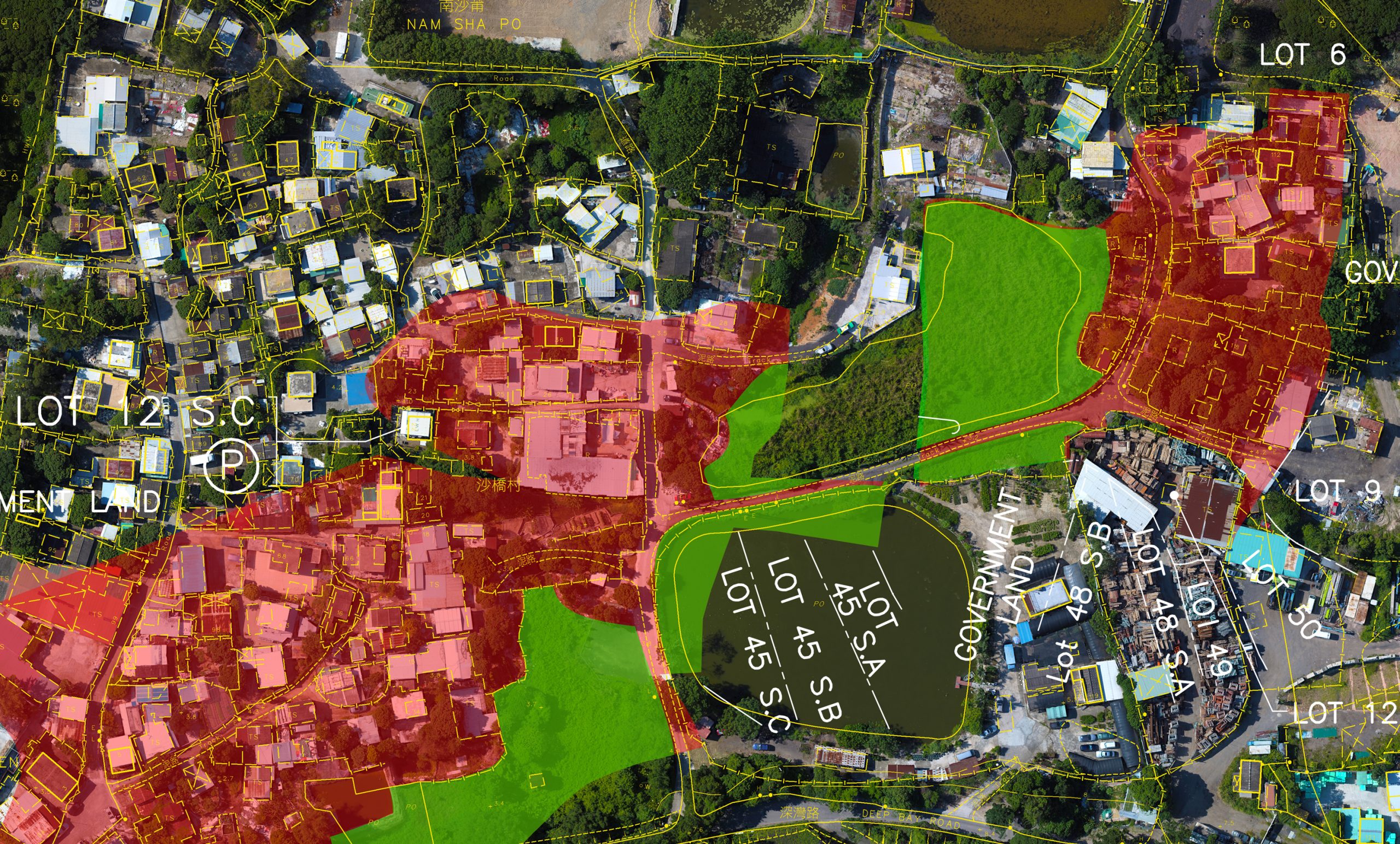

This drone-captured aerial orthomosaic was used to determine plot boundaries in a Northern New Territories location for a private developer who had purchased certain areas for redevelopment. The orthomosaic map gave the client a highly detailed, up to date visual information set which could be directly and precisely compared with ground survey data, and with Lands Department maps of the area.
- Categories:Environmental Analysis, Survey Enhancement