

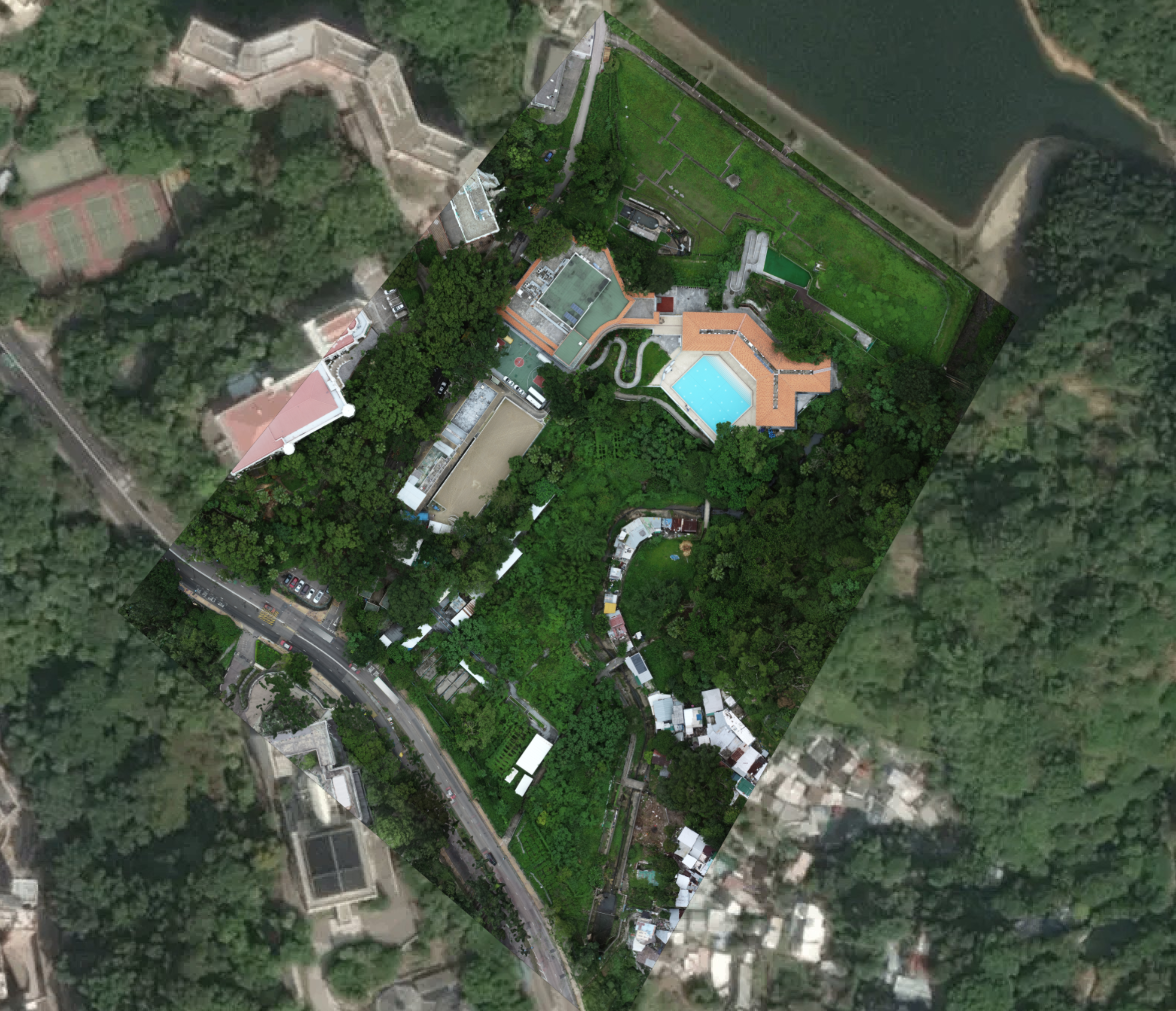
A precise orthomosaic map of the site was generated, here overlaid on satellite image
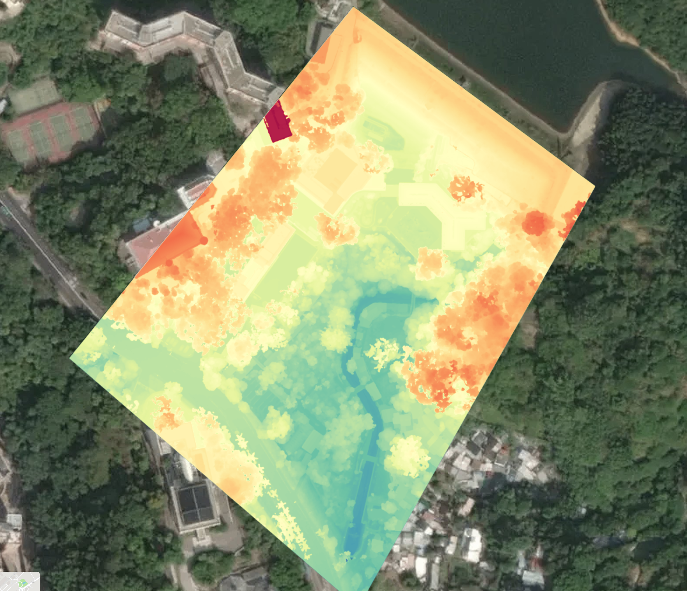
A DSM from the same orthomosaic data was used for measurements
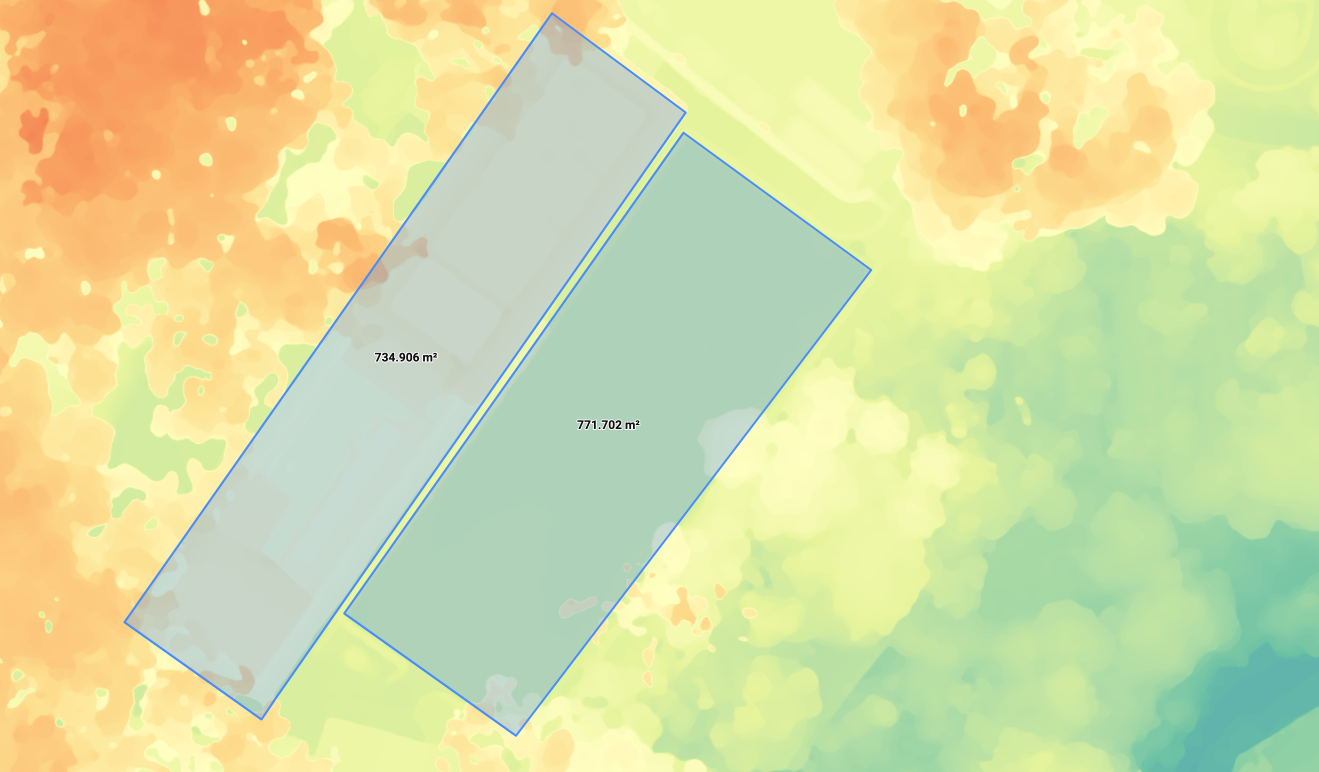
Accurate area and volume measurements could be taken directly off the DSM
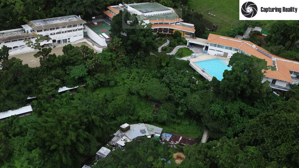
Screen grab from a high resolution rendering of the 3D point cloud model (try the low resolution Sketch fab model above in full-screen mode)
For this project, aerial photogrammetry and point cloud capture were combined with ground-based LiDAR scanning to accurately model the current structural outline, and underlying topography of this location on the south west of Hong Kong Island.
The consulting engineers required an accurate 3D model and map of the entire site, including all existing structures, for a design study.
However, determining the exact ground condition and topography under the thick vegetation cover was going to be difficult using conventional surveying methods.
Dronesurvey Asia employed an Emlid RTK/PPK system in conjunction with an Emlid-equipped Phantom 4 Pro to rapidly photo-map the entire site to within 1.0cm XYZ accuracy, and a GSD of 1.79cm/px. From this, a fully textured, photo-realistic point cloud model was generated in Pix4D, and exported to a number of formats for further manipulation and evaluation by the consulting engineers.
A Digital Surface Model (DSM) from the same photogrammetry map was used to accurately determine area and volume measurements from various structures and elements within the site.
For the LiDAR scanning, we partnered with Red China Geosystems, who used the advanced Riegl VZ-400i 3D laser scanner to penetrate the dense vegetation cover and accurately model the underlying slope forms, shapes and topography.
Combining the precision drone photogrammetry model with the high density ground-level LiDAR point cloud model, the consulting engineers — and the client — had a complete, accurate, and up-to-date picture of the site, both from above (in terms of the existing structures and tree cover) and below (in terms of the underlying ground topography), saving them considerable time: all drone capture and LiDAR scanning was completed on site within one working day.
Check out the LiDAR fly-through below:
- Categories:3D Modelling, LiDAR Scanning, Mapping
- Project URL:https://vimeo.com/375349558/0c018e8086