

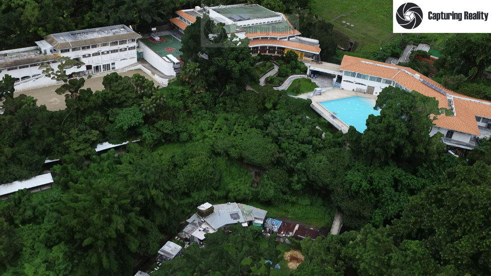
Survey Mapping & 3D Modelling
We offer a precise aerial mapping service for the generation of orthomosaic photogrammetry maps and 3D models, primarily in the construction sector. These are used to check and verify a site prior to construction, as well as essential progress monitoring during construction.
We have an Advanced Operator Permit issued by the CAD for commercial or higher risk UAV operations in Hong Kong, and now have significant experience conducting mapping operations in the tight, mountainous confines found in the Territory.
We have the latest RTK/PPK-equipped UAV systems and can produce precise, detailed maps and models to an XYZ accuracy within several millimetres.
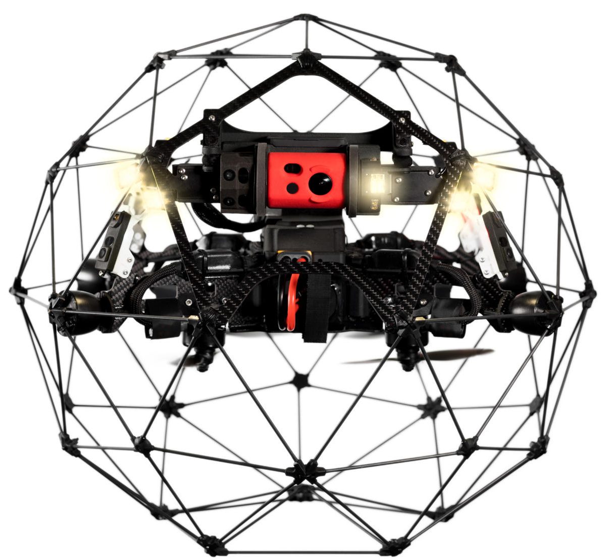
Structural Inspection
Close inspection of key industrial assets and infrastructure can be time-consuming and hazardous. Drones are safer and can save considerable time, delivering results that enhance decision making when it comes to critical asset maintenance and repair.
We have specialised drones for up-close internal and external inspection across a range of applications, including energy and power generation, core utilities like water and drainage, as well as large infrastructure assets such as bridges, highways and rail lines. Our data management solutions can store, track and manage the huge amount of information generated by the drone inspection processes, including AI-based predictive analysis and data mining tools.


Security Monitoring
Drones can provide considerable time and manpower savings when it comes to area monitoring and key asset security, especially for large, sensitive facilities, or assets in remote locations.
Dronesurvey is working with key global partners to introduce autonomous drone control systems, able to automate, control and monitor multiple remote aircraft over a given area 24/7.
Environmental Analysis
Similar drone technologies to those deployed for construction mapping can also be used for environmental impact and land use analysis.
Applications include tree and vegetation health analysis as part of any urban planning or major construction project, or the monitoring of natural, protected areas, both in terms of plant health and wildlife population.

Enterprise Consulting
We provide an independent advisory and consulting service for enterprises looking to run an in-house drone program. This includes strategic advice on core implementation strategies, analysis and recommendations on key drone hardware and associated technologies, bespoke flight training for key personnel (see below) as well as systems management training, plus a comprehensive drone fleet maintenance service.
Specialist Product Partnerships
We partner with and represent a number of specialised precision aerial products, systems and technologies from around the world. These include not only bespoke drones and sensor hardware, but also software and back-end solutions for AI, data management, processing and insight.
We are evaluating and adding new products and technologies all the time.
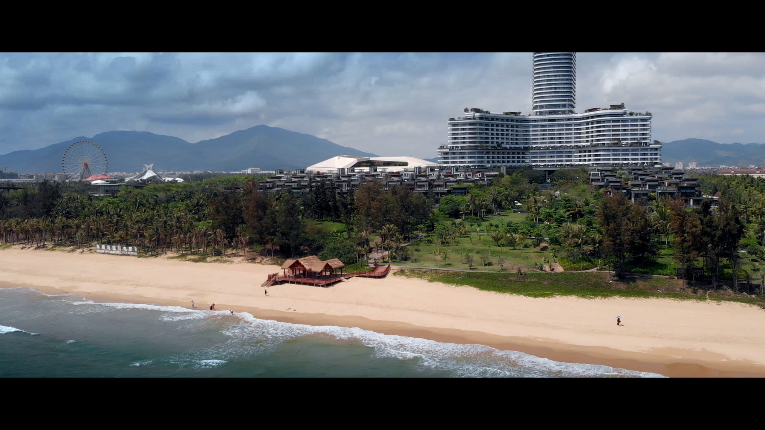
TV and Film Production
We continue to offer extensive aerial filming services for international corporate, TV and film productions looking for high quality, permit-approved aerial work in Hong Kong and Macau.
Our founder Nick Foxall has extensive experience in the film and video industry, having shot footage for a wide range of clients, including BBC Studios, NRK Norway, National Geographic, TVB Hong Kong, HKTDC, and many other production companies.