


Emlid has joined the Esri Partner Network to bring ArcGIS users the benefits of its GNSS gear ecosystem, delivering centimetre-level accuracy at a cost of under US$2,000 per unit.

Emlid already supports GIS professionals across the globe in various workflows—from quick data capture in urban environments to large-scale projects in remote areas. By joining the Esri Partner Network, the company expands its offerings for ArcGIS users with reliable, easy-to-use receivers like the Reach RX (compatible with iOS and Android), enabling centimetre-accurate data collection even in challenging conditions.
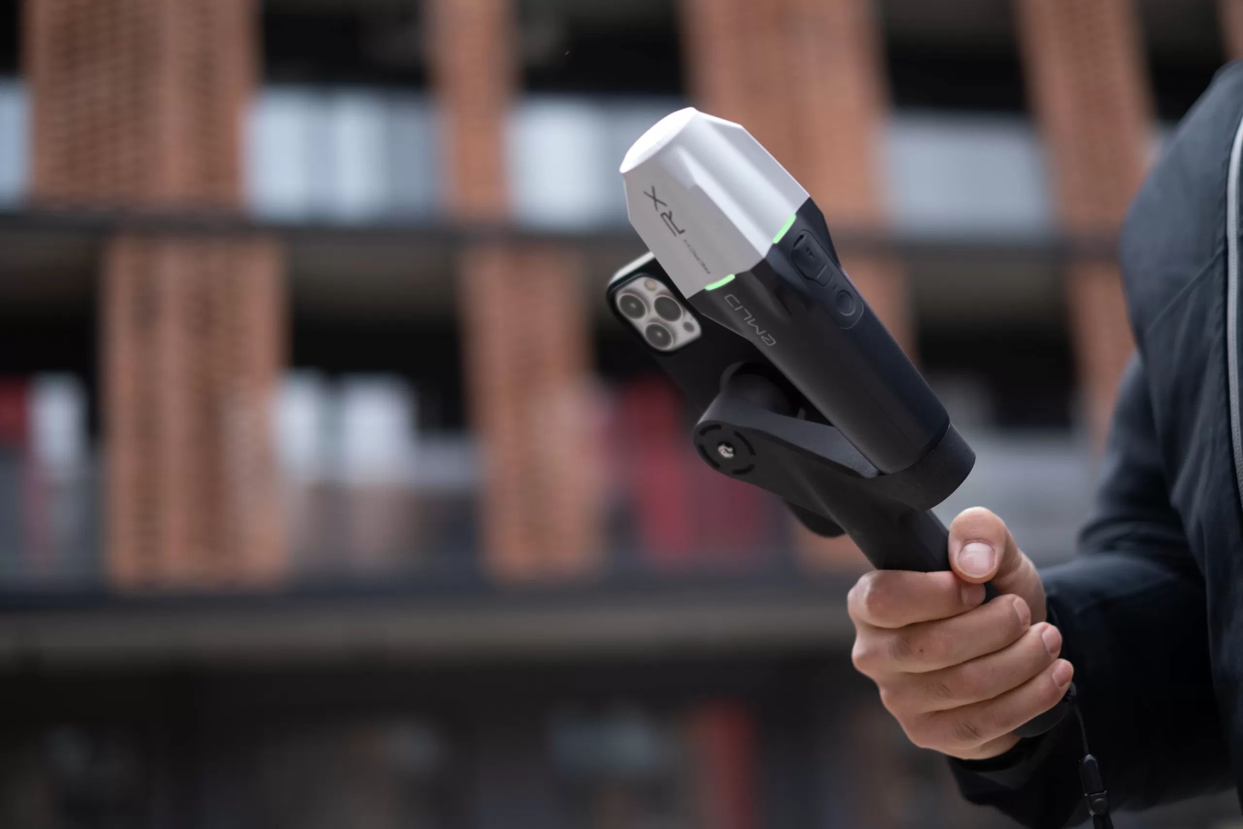
Recently recognised with the Red Dot award, the sleek and lightweight Reach RX (250 grams/0.55 lbs) is designed for GIS professionals and integrates seamlessly with ArcGIS Field Maps, ArcGIS QuickCapture, and ArcGIS Survey123 on iOS and Android. Users can begin collecting RTK data by simply connecting the Reach RX to a CORS or local base. With up to 22 hours of battery life, Emlid receivers effortlessly integrate into existing workflows, providing an efficient solution for geospatial data collection.
In addition to expanding its integrations with Esri products, Emlid will actively engage with the ArcGIS community and offer support at future Esri events, including the upcoming user conferences in the USA and Europe.
Emlid manufactures high-precision RTK GNSS receivers and software for the field and office. Built to
provide centimetre-level positioning even in challenging conditions, Emlid Reach receivers are used for
surveying, GIS, construction, drone mapping, and more. With offices in Lisbon and Budapest, Emlid ships Reach receivers worldwide from its online store with warehouses in the USA and Netherlands and official dealers.
Emlid receivers are available in Hong Kong exclusively through Dronesurvey Asia. Learn more here, or buy direct from our online store!
0 Comments
Leave a comment