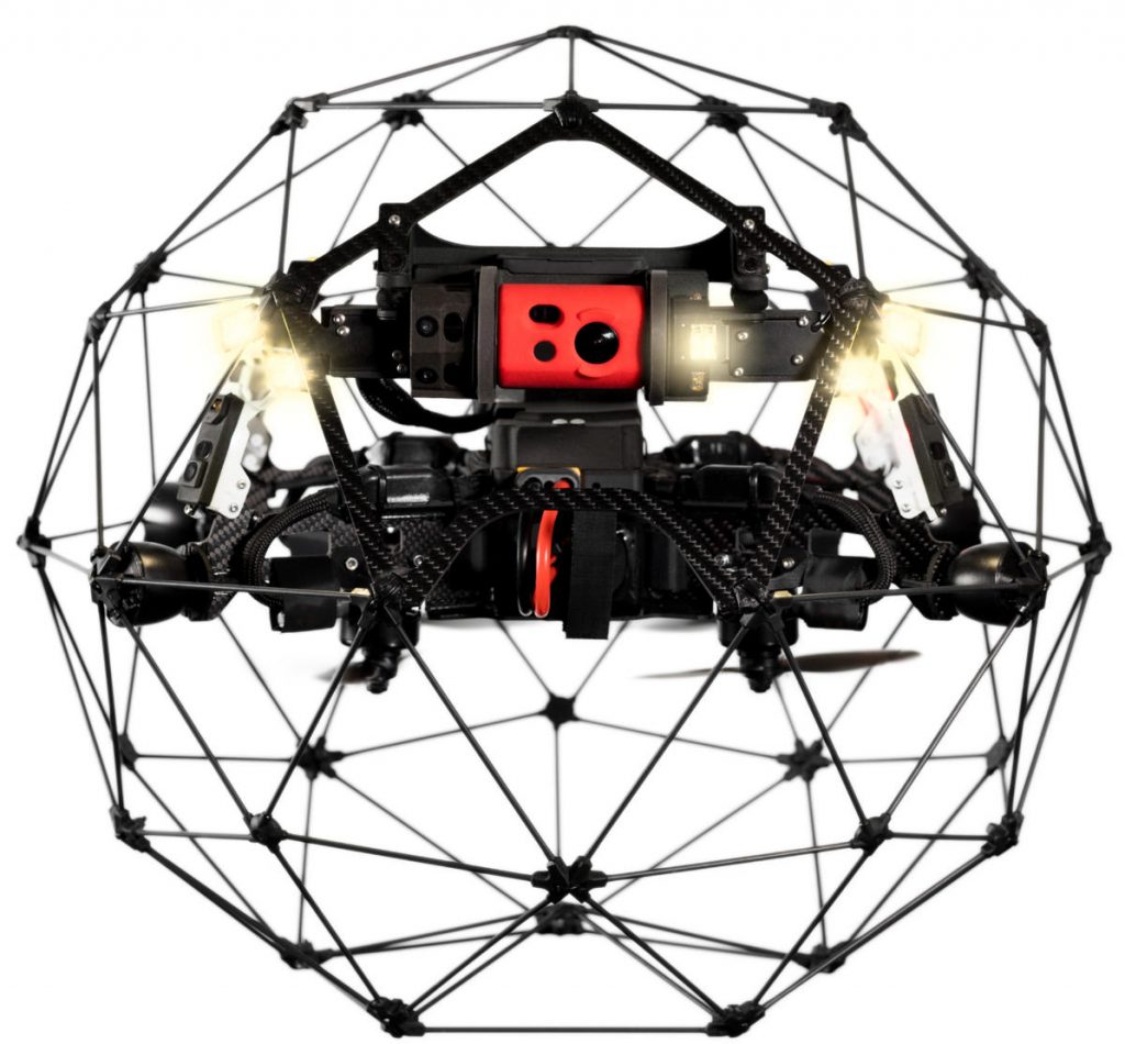
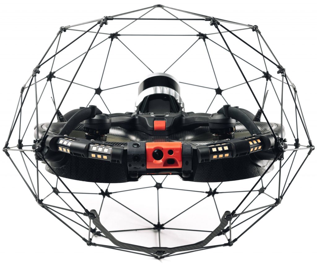
Note, Elios 2 has reached end-of-life and will be discontinued from November 2024. There will be no further sales of Elios 2 after this date. Click here for more options with Elios 3.

What’s the difference between Elios 2 and Elios 3? Well, Elios 3 builds on the success of Elios 2, incorporating all the best features of Elios 2, while offering a number of new technologies and enhancements. Elios 2 will remain available for quite some time: Elios 2 continues to be a robust and proven solution for confined space visual inspections.
| Feature | Elios 2 | Elios 3 |
|---|---|---|
| Cage Size | 400 mm x 365 mm | 480 mm x 380 mm |
| Motors | 4 fast-reversing electric brushless motors | 4 fast-reversing electric brushless motors |
| Noise Level | 99dB | 83dB |
| Take-off Weight with Battery | 1450 gm | 2350 gm (with LiDAR unit) 1900 gm (without LiDAR unit) |
| Ingress Protection | IP42 | IP68 for LiDAR unit, IP44 for drone |
| Operating Temperature | 0ºC to 50ºC | 0ºC to 50ºC |
| Flight Time | 10 minutes | 10 minutes (with LiDAR unit), 12-13 minutes (without LiDAR unit) |
| Max Speed | 1.3 m/s (Assist mode) 4 m/s (Attitude mode) 6 m/s (Sport mode) | 2 m/s (Assist mode) 5 m/s (Attitude mode) 7 m/s (Sport mode) |
| Max Wind Resistance | 3 m/s (Assist mode) 5 m/s (Sport mode) | 5 m/s (Assist mode) 7 m/s (Sport mode) |
| Max Light Output | 10k lumens | 16k lumens |
| Light Options (user controlled) | Indirect (dustproof) lighting Selective oblique lighting Close up lighting | Normal mode (4x panels used) Dustproof lighting (2x outer panels used only) Selective/oblique lighting (left or right side only) |
| RC Transmission Range | Up to 500m, direct visual line of sight | Up to 500m, direct visual line of sight |
| RC Frequency Band | 2.4GHz ISM band (2404MHz – 2483MHz) | 2.4GHz ISM band (2400MHz – 2483.5MHz) |
| RC Link Encryption | None | 128 bit aes-ctr, per the LTE spec |
| Flight Control Sensors | IMU, magnetometer, barometer, 7 vision sensors, and 1 distance sensor | IMU, magnetometer, barometer, SLAM LiDAR, 3 computer vision cameras, and 1 ToF distance sensor |
| Data Localisation and Distance Measurement | Available after post processing in Flyability Inspector Software | Available in real-time with on-screen 3D point cloud (also available in Flyability Inspector Software after import) |
| 3D Modelling Capability | 3D Photogrammetry mesh models with third party software (PiX4D) | 3D Photogrammetry mesh models with third party software (PiX4D); 3D Point clouds with Inspector 4.0; 3D survey grade point clouds with third party software (FARO Connect) |
| Additional Sensors and Payloads | Not Available | Available from Flyability and third parties in the near future |
| Max Weight for Additional Payloads | Not Available | Up to 150 gm (with LIDAR unit), Up to 600 gm (without LIDAR unit) |
| Video Camera | 1/2.3” CMOS Effective Pixels: 12.3 M Sensitivity: Optimised for low light performance | 1/2.3” CMOS Effective Pixels: 12.3 M Sensitivity: Optimised for low light performance |
| Video Format | MOV | MOV |
| Video Size | Ultra HD: 3840 x 2160 at 30 fps Or FHD: 1920 x 1080 at 30 fps | Ultra HD: 3840 x 2160 at 30 fps Or FHD: 1920 x 1080 at 30 fps |
| Photo Format | JPG | JPG |
| Photo Size | 4000 x 3000 px | 4000 x 3000 px |
| Thermal Imager | FLIR Lepton 3.5 | FLIR Lepton 3.5 |
| Thermal Size | 160 x 120 at 9 fps | 160 x 120 at 9 fps |
| Camera Pod Tilt | 90º upward, 70º downward | 90º upward, 90º downward |
Contact us today for a free demonstration, or you can find more information at Flyability.com


