

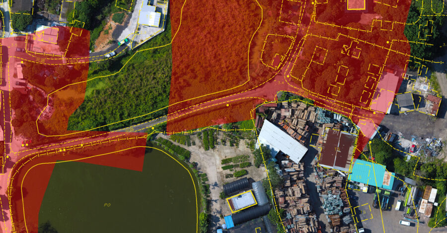
Plot Boundary Analysis
This drone-captured aerial orthomosaic was used to determine plot boundaries in a Northern New Territories location for a private developer who had purchased certain areas for redevelopment. The orthomosaic map gave the client a highly detailed, up to date...
Read more