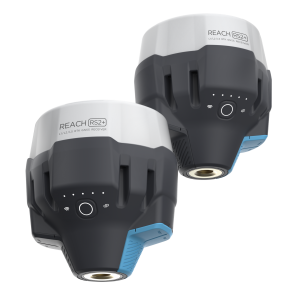

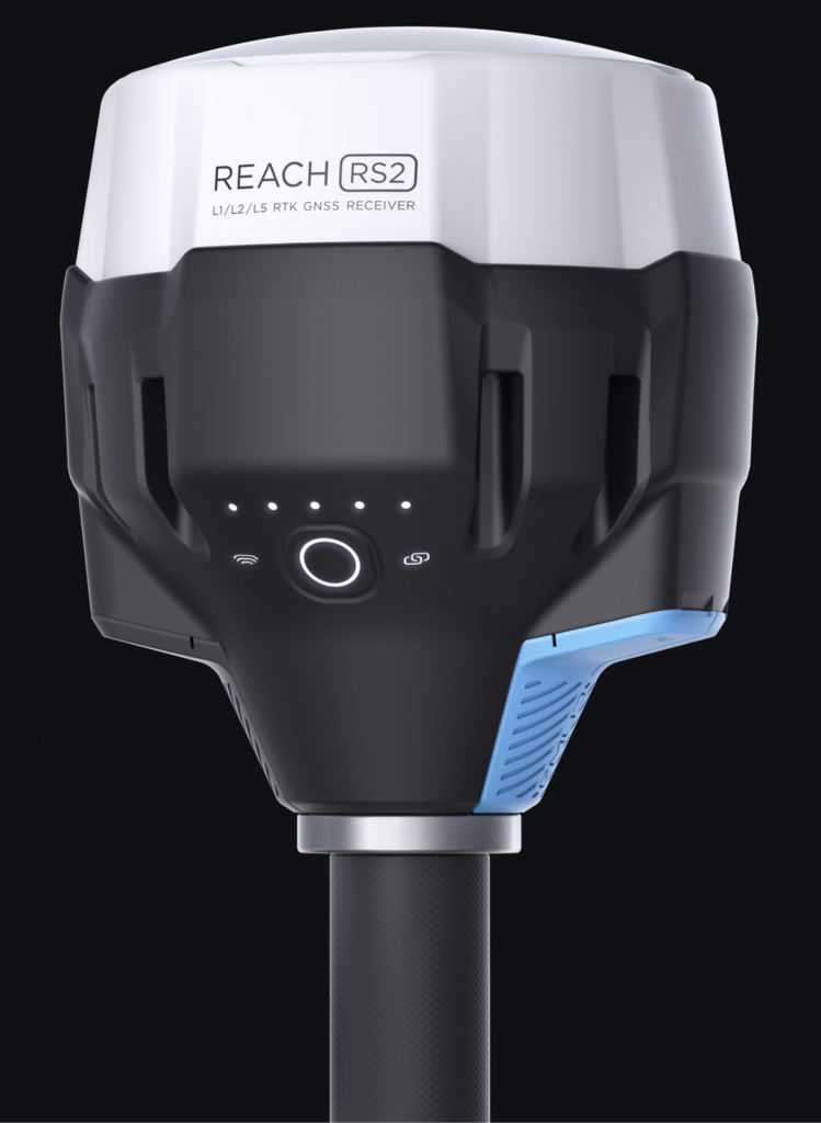
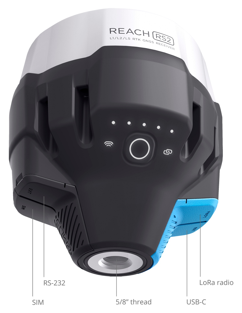
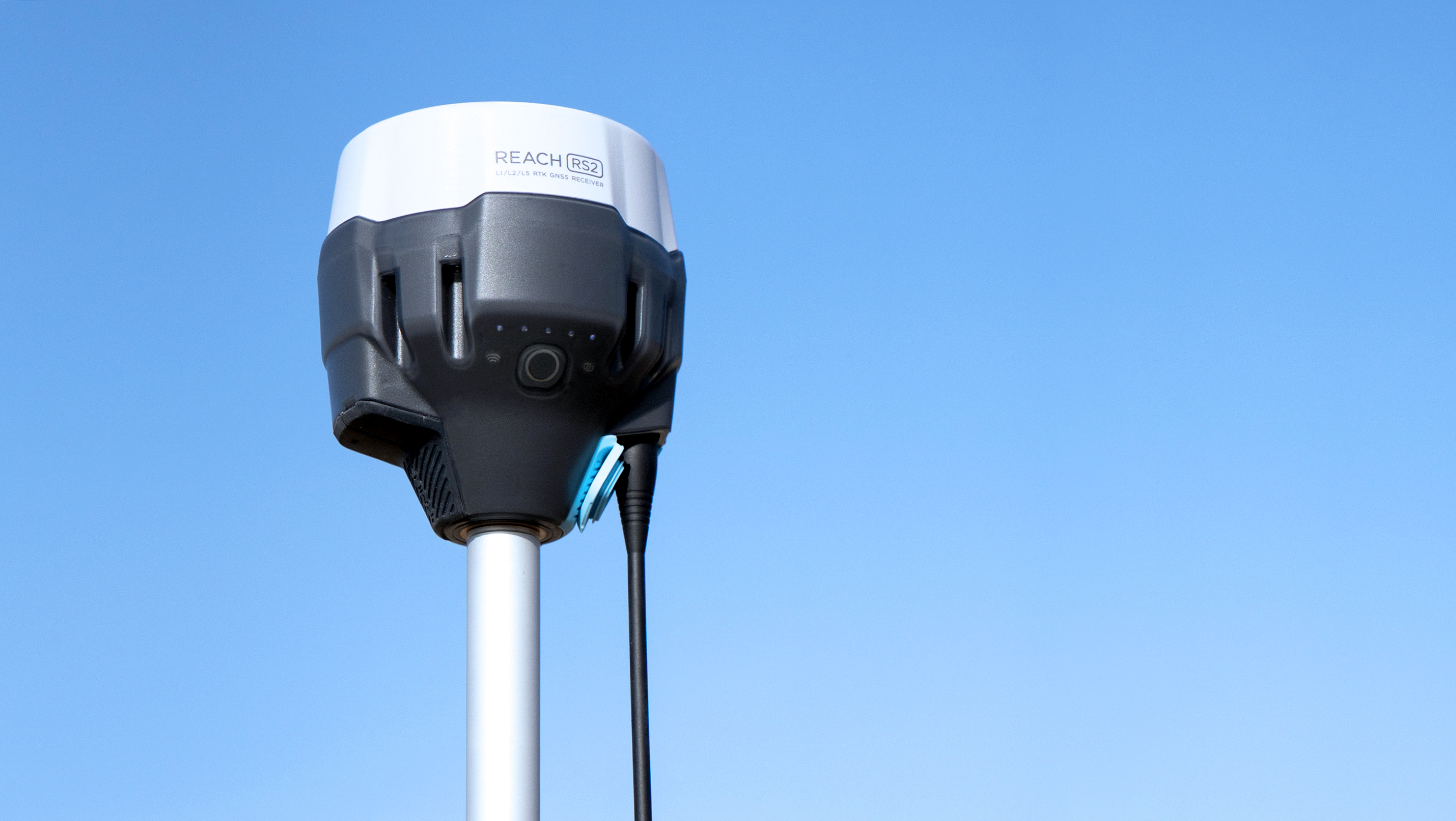
REACH RS2
Multi-band RTK GNSS receiver with centimetre precision
For surveying, mapping and navigation.
Comes with mobile app.
Baseline up to 100 km
Update rate 10 Hz
Gets a fix
in seconds
Reach RS2 gets a fixed solution in just seconds and maintains robust performance even in challenging conditions. Centimetre accuracy can be achieved on distances up to 60 km in RTK, and 100 km in PPK mode.
GPS, GLONASS, BeiDou,
Galileo, and QZSS
L1OF, L2OF, L1C/A, L2C,
E1B/C, E5b, B1I B2I
Built-in
3.5G modem
Reach RS2 features a power-efficient 3.5G HSPA modem with 2G fallback and global coverage. Now corrections can be accessed or broadcasted over NTRIP independently, without relying on an Internet connection on your phone.
PPP
support
RINEX raw data logs are compatible with PPP services so you can now get centimetre-precise results in any place on Earth. Process RINEX files in an online service and get position with absolute accuracy.
22 hours
on 1 charge
Up to 22 hours of autonomous work when logging data and up to 16 hours as a 3G rover, even in cold weather—no more need to carry spare batteries with you. Reach RS2 can charge from a USB wall charger or a power bank over USB-C.
Surveying
with ReachView 3
The most user-friendly software for data collection that is available both for Android and iOS. Supports thousands of coordinate systems and is translated into multiple languages. With ReachView 3, you can collect and stake out points and control all the features of Reach receivers, such as setting up a base station, logging RINEX data, and configuring NMEA output.
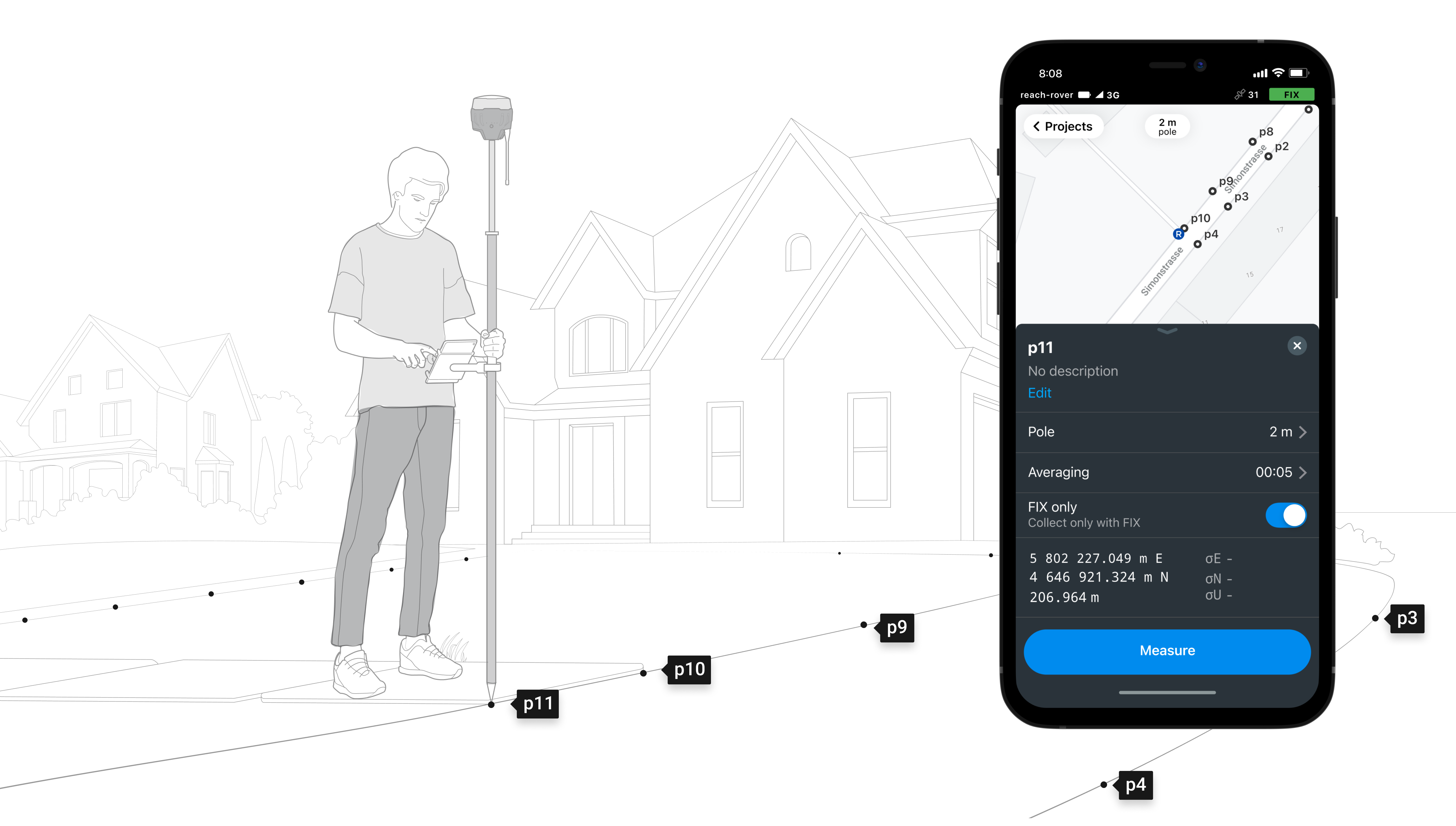
Point collection:
save points, and export data to CSV
Record each position as a point with centimetre precise coordinates. Export projects and open them in GIS or CAD software like AutoCAD, ArcGIS, QGIS, and others.
Coordinate systems based on:
WGS84, NAD83, GDA2020, HK 1980 Grid,
and others

Stakeout:
find a point’s position on the ground
Stakeout is used to find exact physical locations of points. They can be collected in ReachView or imported from other CAD or GIS software.
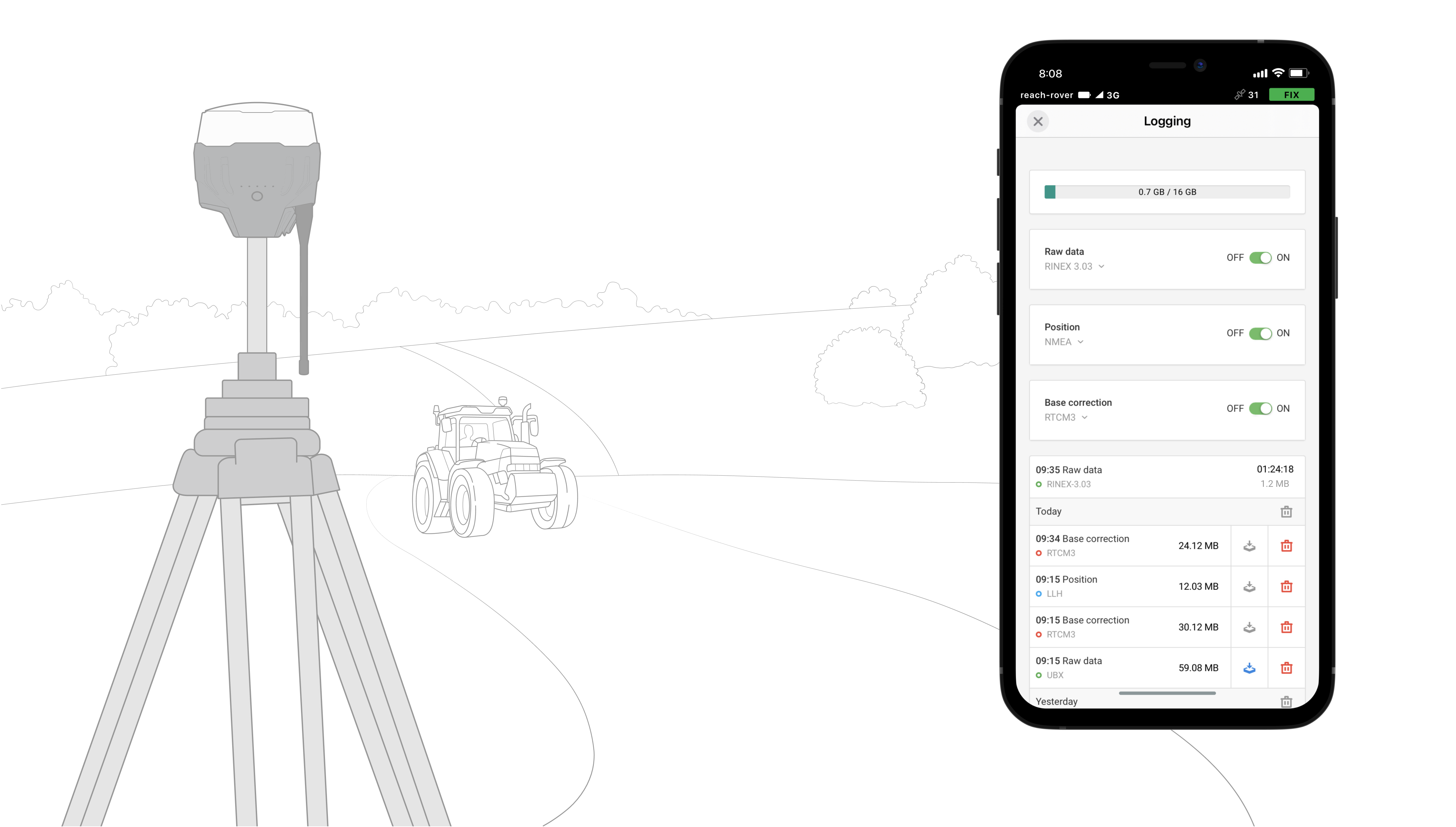
Logging in RINEX:
record raw data, position, and base correction logs
Record raw data, position and base correction logs. Point collection and recording of RAW data are independent processes and can be used simultaneously. ReachView has a simple and intuitive interface for logging configuration and control.
We provide our version of RTKLib for PPK. It’s free and can be downloaded from our docs.
16 GB
storage
160+ days
of logging at 1 Hz
PPP for OPUS
RINEX raw data logs are compatible with PPP services so you can now get centimetre-precise results in any place on Earth. Process RINEX files in an online service and get position with absolute accuracy.
Compatibility
Real-time position
streaming in NMEA
Reach provides data in standard NMEA that is used by most GIS apps. Simply connect your device to Reach over Bluetooth or with a cable, and turn on “Position output” in ReachView.
Reach can turn on and off automatically
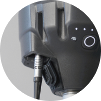
Reach is able turn on and off in sync with an external battery connected over RS-232. This helps when the power button is hard to reach. For example, if the receiver is placed on the roof of a tractor.
Compatible apps
MachineryGuide, AgriBus-Navi, Efarmer, Agripilot, and others
Position Streaming
Interfaces:
RS-232, TCP, Bluetooth
NTRIP or another Reach
as a base station
Reach RS2 needs a base station as a source of corrections. That’s a requirement for centimetre accuracy in RTK and PPK. Base might be either another Reach RS2 receiver or an NTRIP service. VRS is also supported.
Reach RS2 works seamlessly with other Reach receivers over any link.
Input and output corrections
Interfaces:
TCP, LoRa, Bluetooth, RS-232, NTRIP
Formats:
RTCM3
Max distance from a base
Over 60 km in RTK
100 km in PPK
Any place on Earth with PPP
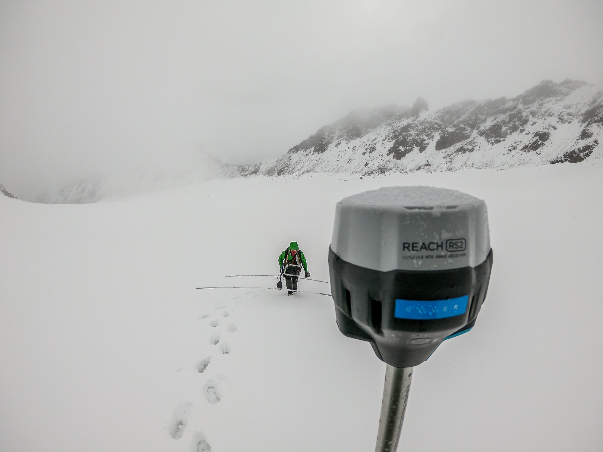
Engineered to be tough
Reach RS2 is designed to work in the most challenging environments
IP67
RS2 is waterproof up to 1 m depth. All connectors are completely sealed and protected from water and dust with silicone plugs.
-20ºС…+65ºС
We extensively tested Reach RS2 in conditions that simulate coldest winters and hottest summers.
Polycarbonate body
Polycarbonate, an extremely durable material that is used in bulletproof glass, makes Reach RS2 impact-resistant
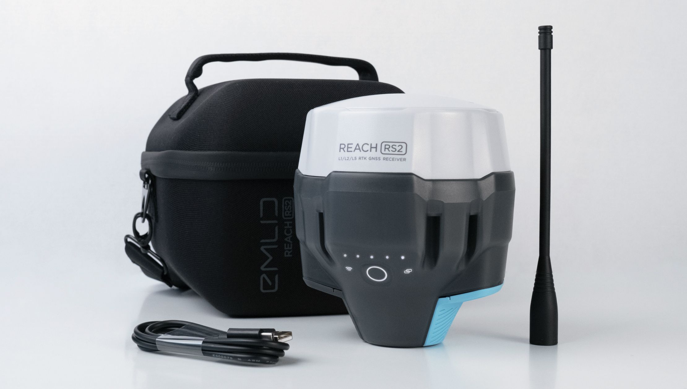
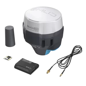
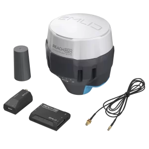
Comes with LoRa antenna, USB cable, and carrying case with a strap
Specifications
Buy now!
Shop with confidence in our secure online store. Free delivery in Hong Kong!