

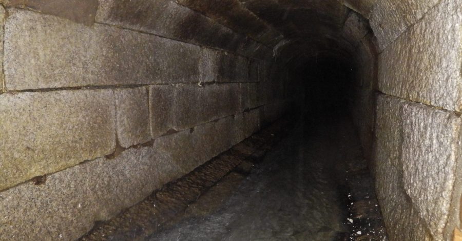
Storm Water Culvert Inspection
The Elios 2 has proved invaluable for inspecting drainage and sewage infrastructure in Hong Kong. In the case of storm water drains and culverts, access is often extremely difficult and limited, with many culverts too narrow for manned inspection...
Read more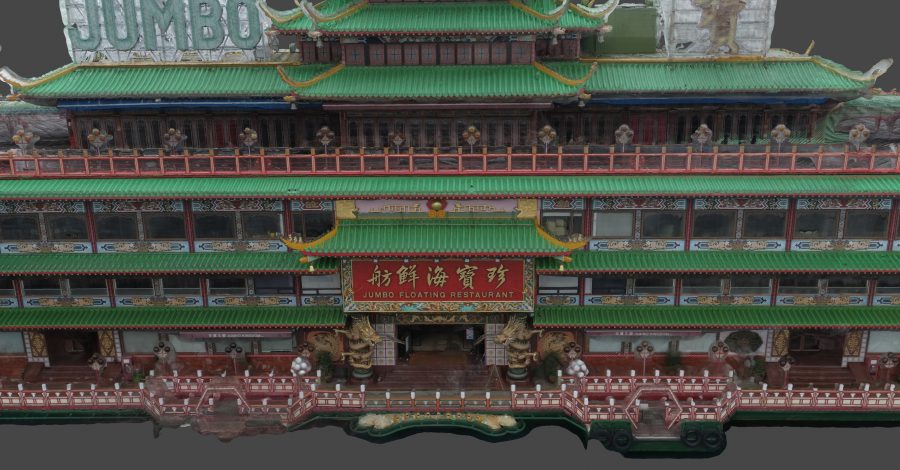
3D Scanning for Movie VFX
We have undertaken a number of 3D scanning and modelling projects for international movie and TV productions. For one recent international blockbuster production for Netflix, the producers required a full 3D scan of the (since departed) Jumbo Restaurant in...
Read more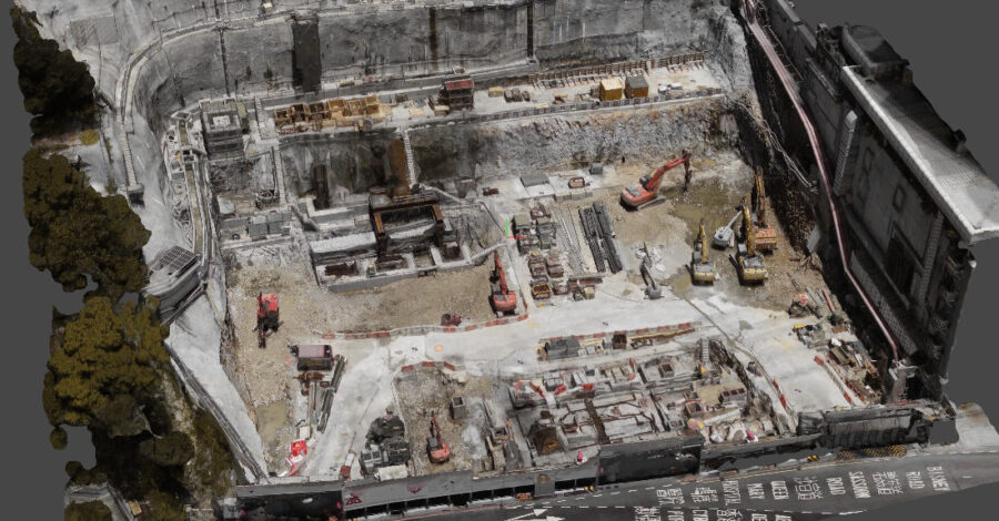
Slope Formation Analysis
As part of the Hong Kong Hospital Authority’s 10-year Hospital Development Plan, a new acute block is being constructed adjacent to an existing hospital. To facilitate as much space as possible for the new acute block, some of the existing...
Read more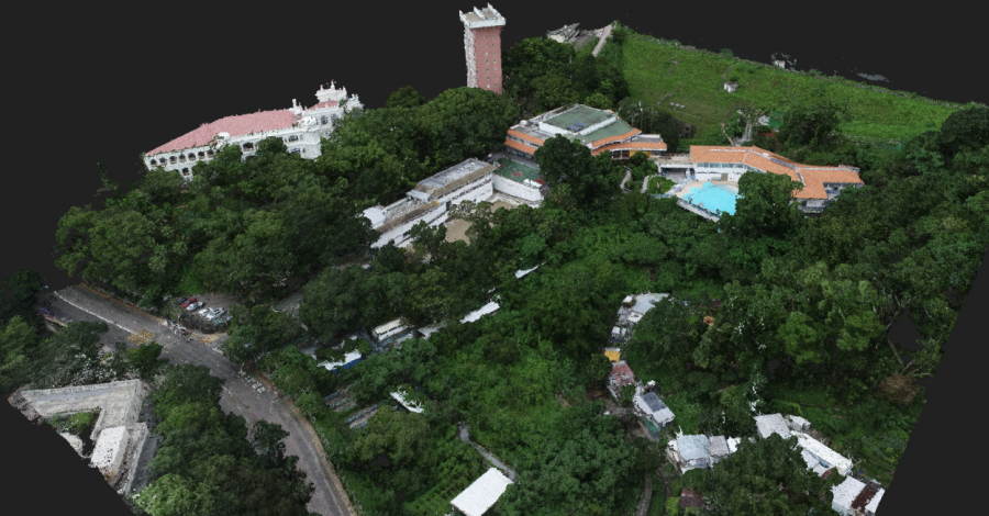
Survey and Topography Assessment
For this project, aerial photogrammetry and point cloud capture were combined with ground-based LiDAR scanning to accurately model the current structural outline, and underlying topography of this location on the south west of Hong Kong Island. The consulting engineers...
Read more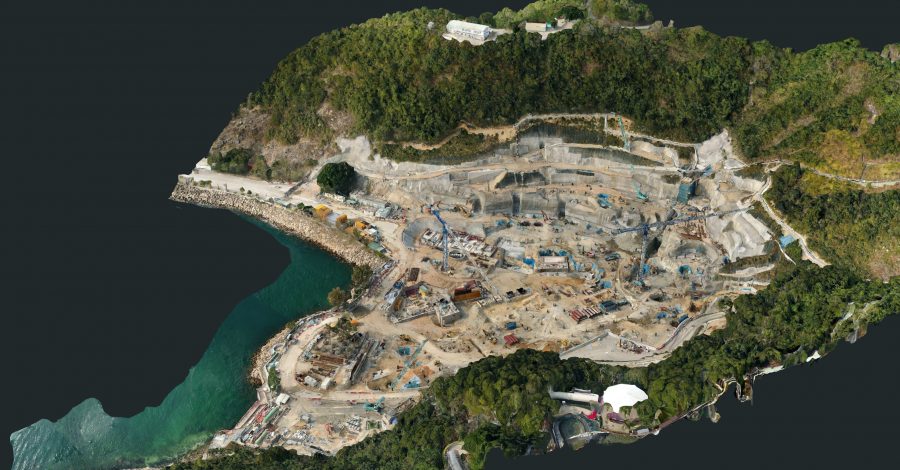
Construction Progress Modelling
For the Ocean Park Waterworld project, precise, detailed orthomosaic maps and 3D models were captured and generated on an ongoing basis to monitor and assess slope formation and foundation work. The tight confines of the site and the steep...
Read more