


- SLAM-enabled stability in GPS-denied environments
- real-time 3D mapping as you fly
- 4K video + thermal
- 16K lumen lighting
- multiple payloads option
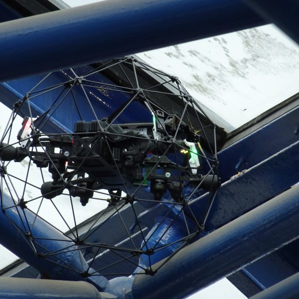
Confined Space Inspection with LiDAR
Drone Products
and Technologies
Precise 3D Point Clouds
for confined spaces
- sub-centimetre accuracy
- advanced processing algorithms
- 1.3 million pts/sec
- 100m range
- FARO Connect
software included
Safe remote thickness measurements
- Accurate live A-scans
- 3D map localisation for
repeatable measurements
- Interchangeable probe heads
- Versatile probe head orientation
- Cleaning brush attachment
Professional Photogrammetry
and Drone Mapping Software
Drone Solutions
• EMAT
• DFT
Photogrammetry
Multi-Band GNSS Receiver
with Tilt Compensation
for All Critical Assets
Hong Kong’s Enterprise Drone Experts
Dronesurvey Asia is Hong Kong’s leading enterprise and commercial drone solutions provider. Since 2016 we’ve helped numerous enterprises and government agencies make productive, long term use of drones and UAV technologies.
We provide surveying, mapping and close inspection services across construction, infrastructure, utilities, and public services, using only the most advanced and proven drones, sensors and data processing technologies, for both outdoor and enclosed space applications.
What can Dronesurvey Asia do for you?
We bring to Hong Kong the most advanced drone technologies and solutions from around the world.
Take a Closer Look
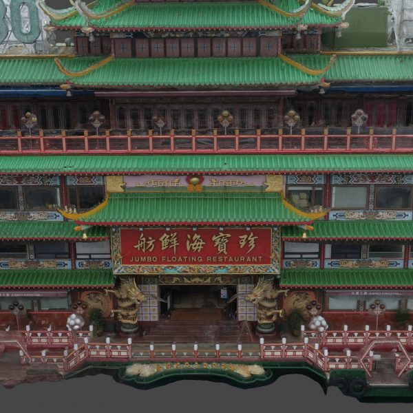
Hong Kong above and below – scanned, inspected and 3D modelled. A selection of our recent projects.
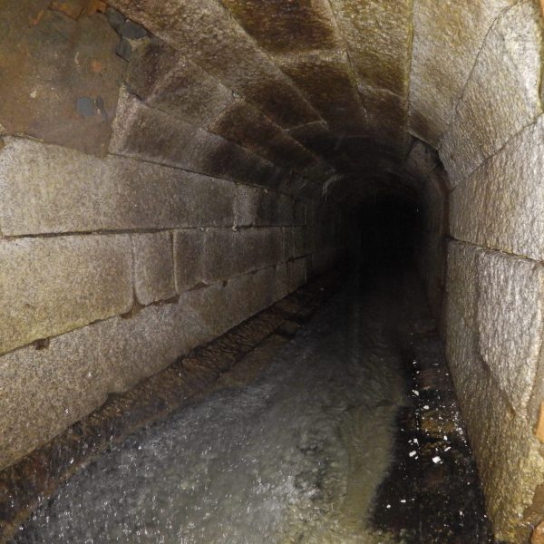
Storm Water Culvert Inspection
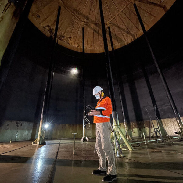
Storage Tank Inspection
3D Scanning for Movie VFX
Slope Formation Analysis
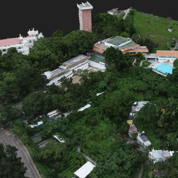
Survey and Topography Assessment
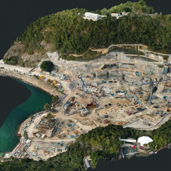
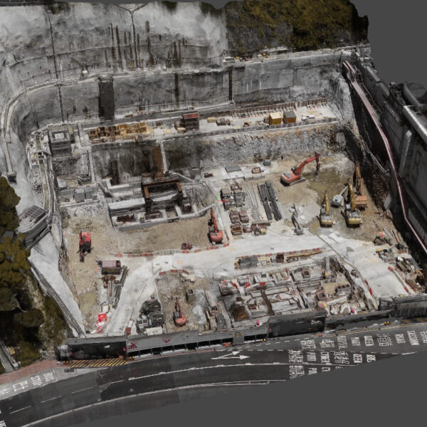
Construction Progress Modelling
Steel Roof Inspection
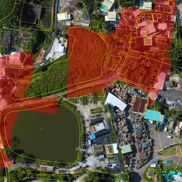
Plot Boundary Analysis

Aerial Video for Film and TV
Why Choose Dronesurvey?
We see drones as essentially an “aerial platform for a sensor”. Whether that’s a camera, a thermal sensor, a LiDAR scanner, or even an NDT probe, drones are an efficient, reliable, cost-effective and – most importantly – a safe way of gathering crucial data across a wide range of disciplines and industries.
Drones can collect a lot of data. You need ways to efficiently manage, process and analyse that data so you can gain the immediate insight you need to make critical decisions.
How do you deploy drones in an efficient manner? How do you turn drone data into actionable insight? And how do you do it safely, within the law?
That’s where we come in. Dronesurvey Asia is your Enterprise Drone Solution. Get in touch.


Leading Clients
Major infrastructure, construction and broadcast enterprises rely on Dronesurvey Asia.
Key Services
Delivering cost and time saving advantages across the enterprise.